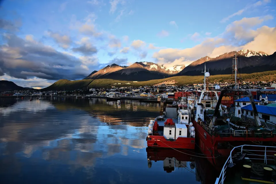
End of the World City Tour
About 2 h around Ushuaia: from La Misión to the Martial Glacier base.
- 2 hours
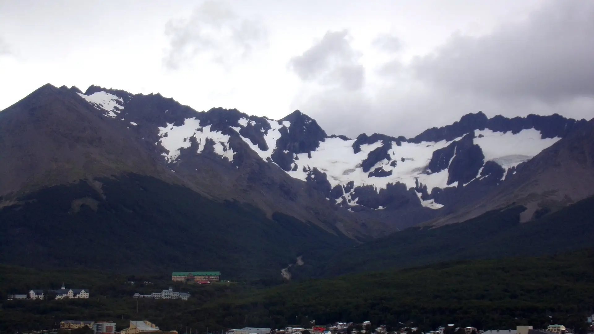
The Martial Glacier (Glaciar Martial) is a cirque glacier above Ushuaia, inside the Louis Martial Protected Natural Area, 7 km from downtown. You can get to the base by car, taxi or remís; from there you walk about 1,300 m up to a viewpoint, and the trail to the glacier adds another 1,600 m, rated as highly difficult.
Just 7 km from downtown, in the mountains north of Ushuaia, this imposing body of ice dominates the city’s landscape. It lies inside the Martial Glacier Protected Natural Area and is a cirque glacier, characterized by the natural amphitheater carved into the mountain. Today it is considered a glacial remnant, living proof of a far larger mass of ice in times past.
Its name honors the French naval officer Louis Ferdinand Martial, who led the 1882-1883 scientific expedition aboard La Romanche to record the astronomical transit of Venus. Its meltwater feeds the Buena Esperanza stream, a vital source of the city’s drinking water. To protect the richness of its ecosystems and watersheds, the reserve was formally established in 1990 under Territorial Law No. 434.
Its slopes are covered with dense lenga and guindo forest and scattered ñire, framed by peaks that reach 900 to 1,000 meters above sea level. From the base of the glacier you get a privileged panoramic view of the city, the waters of the Beagle Channel and the outlines of Hoste and Navarino islands.
To reach the base you can take the paved Luis Fernando Martial road, a winding climb of about 7 km from downtown. You can go up by car, taxi, remís (private car service) or bike and, if you like walking, there is a lovely interpretive footpath. At the base you will find the old chairlift, a cozy tea house and a mountain hut, ideal for taking a break.
The climb is clearly divided into two sections:
The reserve has four authorized circuits. All of them start at Refugio Base along the Pioneers’ Trail (Sendero de los Pioneros):
| Circuit | Total distance | Elevation gain | What you see |
|---|---|---|---|
| Forest (Del Bosque) | 1,400 m | 100 m | Lenga, coihue and ñire forest beside the stream, erratic boulders from the last glaciation and the Coihues viewpoint |
| Glacier Viewpoint (Mirador del Glaciar) | 2,500 m | 220 m | The forest thins out with altitude up to the valley overlooking the glacial cirques |
| Lagoons Viewpoint (Mirador de las Lagunas) | 5,500 m | 270 m | A 180° panorama from the Beagle Channel and three lagoons in a high valley |
| Clouds (De las Nubes) | 6,200 m | 520 m | A climb up the terminal moraine, close to the ice, to the Condors viewpoint (Mirador de los Cóndores), at 850 m |
Allow plenty of time and start walking in the morning or with plenty of daylight ahead. For the Clouds Trail, it is recommended to book an excursion with an operator or an agency.
Opening hours, fees and whether the chairlift is running change with the season: check them before you go at Ushuaia’s tourist information office.
In winter the favorite activities are alpine skiing and snowboarding, and in summer it is one of the most accessible places to go hiking. Before you reach the base, there is the Francisco Jerman cross-country ski track, run by the Club Andino Ushuaia. What changes in each season is in Ushuaia in winter and Ushuaia in summer.
The Martial has been going through a marked retreat, especially noticeable since the second half of the 20th century: between 1984 and 2003 it lost about 50 cm of thickness a year on average. Later, between 2003 and 2011, that loss slowed down somewhat thanks to cooler summers and higher precipitation.
About 2 h around Ushuaia: from La Misión to the Martial Glacier base.
If you are looking for a guided trek with transfers, the guide to hiking in Ushuaia compares Laguna Esmeralda and the Ojo del Albino and Vinciguerra glaciers. What else to do in the city is in Ushuaia, and if you are short on time, in what to do in Ushuaia in one day. To choose when to travel, see when to visit Ushuaia.
In the Martial Mountains, north of Ushuaia, inside the Louis Martial Protected Natural Area, 7 km from downtown.
To the base, by car, bike, taxi or remís along the Luis Fernando Martial road. From there, on foot: about 1,300 m up the ski run to the viewpoint and another 1,600 m along the trail to the glacier.
The trail from the viewpoint to the glacier is highly difficult, with loose ground and a steep slope. The section from the base to the viewpoint takes around 40 minutes, depending on your fitness.
There are four circuits: Forest (1,400 m), Glacier Viewpoint (2,500 m), Lagoons Viewpoint (5,500 m) and Clouds (6,200 m, with 520 m of elevation gain).
Whether it runs, its opening hours and its fees change with the season: check them before you go at Ushuaia’s tourist information office.
No. The city tour reaches the base of the Martial Glacier Reserve, in the Tea House area, with a view of the glacier, but it does not include the trek or admission to the reserve.
