Garibaldi Pass by E-Fatbike
E-fatbike from Lake Escondido to the Garibaldi Pass lookout: 30 km.
- 8 hours
- Moderate

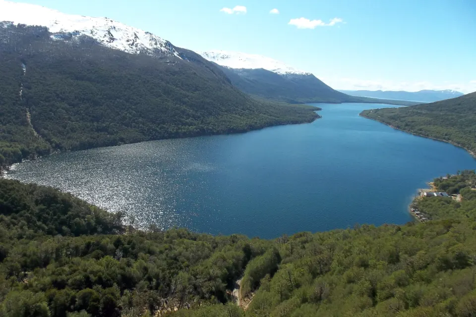
Garibaldi Pass (Paso Garibaldi) is where National Route 3 crosses the Fuegian Andes, at about 450 m above sea level. From its viewpoint you see Lake Escondido, about 60 km from Ushuaia, and beyond it part of Lake Fagnano.
It sits at km 3007 of National Route 3, on the stretch linking Ushuaia with Tolhuin. It is the southernmost mountain road crossing in the world and the highest point of the whole route, reaching about 450 meters above sea level in the heart of the Fuegian Andes.
At the highest point of the crossing awaits its famous viewpoint, built on two levels to give you one of the most striking panoramic views on the island. From there you see, in the foreground, the calm of Lake Escondido guarded by the mountains and, farther off on the horizon, the vastness of Lake Fagnano (or Khami, in the native language). It is a must-stop spot to pause, breathe the pure mountain air and take amazing photos.
Its name honors foreman Luis Garibaldi Honte, a road-department worker of Selk’nam origin who charted the way across the mountains in the summer of 1935-1936. The feat of finally linking the north and south of the island came in November 1956, when a jeep from the National Roads Administration made the first crossing. Years later, between 1968 and 1970, that original route, now remembered as “Garibaldi Viejo”, was modernized to make way for the paved road we travel today.
It is the beautiful glacial lake we see from above, north of the pass and about 60 km from Ushuaia. With just over 7 km² of surface and up to 67 meters deep, its shores offer an ever-changing landscape of rock cliffs, calm bays and cobble beaches, surrounded by dense lenga and guindo forest. Along its shores it is very common to see the lodges and dams built by beavers. Beside the water is the picturesque settlement of Lago Escondido, with its classic historic inn on the shore.
An important detail: don’t confuse it with the lake of the same name in Río Negro (near El Bolsón)! This is our Fuegian Lake Escondido, set in the heart of the mountains.
Further along the route appears the imposing Lake Fagnano, one of the largest lakes in the country, stretching about 104 km from west to east (covering some 590 km²). 93% of its basin lies in Argentina and the remaining 7% in Chile, where it drains.
The ancient Selk’nam called it Khami, meaning “big water”, while its current name honors the Salesian Monsignor José Fagnano. Geologically it is fascinating: its long shape, stretched out along the mountains, follows the Fagnano-Magallanes fault, the natural boundary between the South American and Scotia tectonic plates. The picturesque town of Tolhuin is the main urban center on its shores.
We head north along the legendary National Route 3. As the city falls behind, the landscape offers striking views: we pass the slopes of Mount Olivia and Cinco Hermanos and skirt the wide Carbajal Valley with its characteristic peat bogs. Further on we enter the Tierra Mayor Valley, where the trail to the famous Laguna Esmeralda starts. From there, the road becomes more winding and climbs until it crosses the mountains at Garibaldi Pass. To go down to the shores of Lake Escondido we take a scenic gravel side road near the top, enjoying the shades of the Fuegian forest.
The pass is fully paved and open all year, although in winter there may be very occasional temporary closures after heavy snowfall while the road is cleared. That is why, in the cold months, we always check the forecast and road conditions before setting off.
A historical note about the area: beavers were introduced to the island in 1946 and originally released in the Lake Fagnano area. You can learn more about their environmental impact in beavers in Tierra del Fuego. To add this outing to your summer itinerary, see Ushuaia in summer, or discover all the options in the area in things to do in Ushuaia.
At km 3007 of National Route 3, between Ushuaia and Tolhuin. It is the road crossing of the Fuegian Andes, at about 450 m above sea level.
About 60 km north on National Route 3. Before you get there, the road crosses the mountains at Garibaldi Pass.
Lake Escondido below and, beyond it, part of Lake Fagnano, with the mountains all around.
It covers about 590 km² and is about 104 km long. It is shared by two countries: 93% of its basin is in Argentina and 7% in Chile.
No. The Río Negro lake is between El Foyel and El Bolsón; this is Lake Escondido in Tierra del Fuego, about 60 km from Ushuaia.
The e-bike tour, in summer (about 8 hours and 30 km), and the beaver-watching tour with dinner (about 6 to 7 hours), in fall, spring and summer.
E-fatbike from Lake Escondido to the Garibaldi Pass lookout: 30 km.
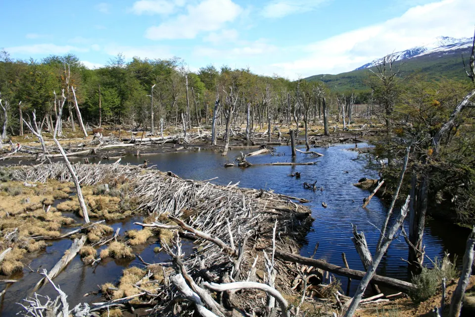
Garibaldi Pass, beaver dams and a three-course dinner, in the afternoon.
